nostalgeo wins the audience award at Apps For Europe
After winning AppsforGeo and AppsforFlanders, nazka's nostalgeo also won the audience prize at Apps for Europe.
read more
5 december 2025
WIMBY (Wind in My Backyard) is a research and engagement initiative led by Utrecht University and partners, offering a free suite of tools – an online map, discussion forum and immersive 3D platform – to support transparent, inclusive and science-based wind farm planning across Europe. The interactive map optimises turbine locations and visualises impacts such as noise, biodiversity and visual change, making expert wind data accessible to non-experts with nothing more than a browser and internet connection.
Nazka developed the web-based interactive map that allows users to design wind farm projects at any location in 28 European countries and immediately assess multiple societal and environmental impacts. Combined with the integrated forum, this enables stakeholders to share scenarios, discuss trade-offs and build a shared evidence base for better local decisions.
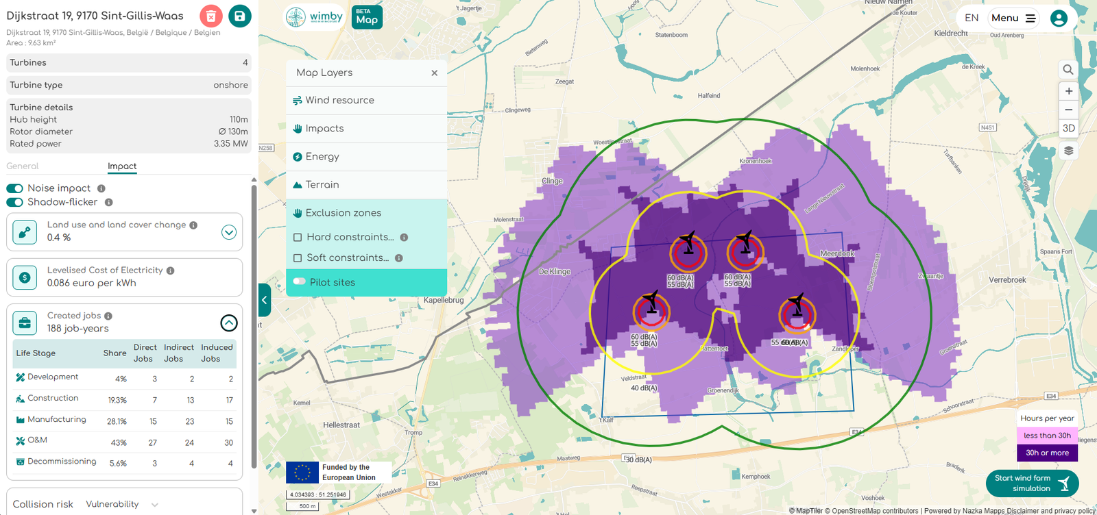
WIMBY shows how geospatial technology and open data can help bridge the gap between expert analysis and public perception, turning complex energy system choices into intuitive visual information. Co-created and tested with stakeholders in Italy, Austria, Portugal and Norway, the tools have received very positive feedback, including from wind energy sceptics, and support a more just and inclusive European energy transition.
Curious to see how this works in practice? Explore the WIMBY tools and start designing your own “wind in my backyard” scenarios here: https://map.wimby.eu/. If you are working on wind or grid projects and want to co-create similar participatory mapping tools, Nazka Mapps is happy to connect.


