nostalgeo wins the audience award at Apps For Europe
After winning AppsforGeo and AppsforFlanders, nazka's nostalgeo also won the audience prize at Apps for Europe.
read more
21 february 2025
Did you know that Europe has some 68,000 km of coastline? And that almost half of all EU citizens live less than 50 km from the coast? This concentration of people and activities has a solid impact on marine biodiversity, water quality and ecosystems. So proper monitoring of these vulnerable areas is crucial - but also time-consuming. That's where ENHANCE comes in.
What does ENHANCE do?
The project combines COPERNICUS satellite data, field measurements and citizen science to monitor the state of coastal waters more efficiently. AI models are used to map and predict effects of human activity on eutrophication and biodiversity.
Three pilot sites - three challenges:
📍 Barcelona, Spain - Tourist pressure & erosion
Annually, >10 million tourists visit this coastal zone. Artificial beaches erode rapidly, leading to silting and eutrophication. Dive tourism also has a direct impact on marine life.

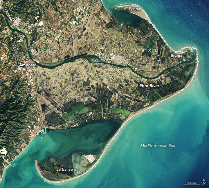
📍 Ebro Delta, Spain - Agriculture & nutrient influx
This region has intensive rice cultivation. After harvest, fertiliser-rich river water flows into the sea, disturbing the coastal ecosystem. The impact on biodiversity has not yet been sufficiently mapped.
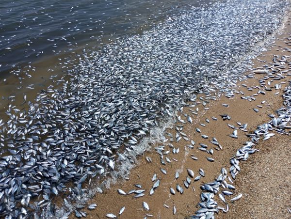
📍 Pagasetic Gulf, Greece - Natural disaster & recovery
After heavy flooding in 2023, mud, waste and carcasses flowed into the sea. The result? Massive fish kills. ENHANCE investigates how quickly such an ecosystem can recover.
We are proud to be responsible for designing and developing the user interfaces in this project. In co-creation with local stakeholders, we are building interactive map applications that support policymakers, scientists and citizens in making informed decisions.
Together with our partners, we look forward to contributing to a more sustainable future for our European coasts!


